Entradas

Mostrando entradas de mayo, 2021

ROUTE 2 WAYPOINT 15

Imagen
Point 15. La Panera House, also on the Arrecife (Map Route 2) We finish this route with another example where we can see how this house, which was La Panera where the tithes and ecclesiastical first fruits were collected, sits directly on the rock of the Arrecife, which formed terraces, which configures the up and down position of the dwellings.

ROUTE 2 WAYPOINT 14

Imagen
Waypoint 14: Town Hall Alley     (Map Route 2) Here in the centre of the village, in this undeveloped corner, we can see how the whole town is built on this reef of rudists, in this case Hippurites incisus in a living position. Who ruled 80 million years ago, is located a few metres from what is now the building of the governing body of the current town. In Castrojimeno the past and the present go hand in hand, linking progress to this heritage that for so many millions of years, marked the environment and that today is intended to be valued, as another ancestor that marks the roots of this population.

ROUTE 2 WAYPOINT 12

Imagen
 Waypoint 12: Don't let the plants prevent you from seeing the reef.  (Map Route 2) The whole village of Castrojimeno is settled mostly on bio-construction. If at the northern end of the village points 3-4 and 5, we had the reef, now in its opposite we have the same. However, if in the other points the urbanization had created ideal outcropping conditions, now we have the rocks in their most natural aspect, at this point the Radiolites Sauvagesis stand out, although we also find Hippurites and Biradiolites . It is striking to see how these rudists, sometimes act almost like flowerpots, being small holes are filled with soil and encourage the seeds of plants to germinate; the problem is that this favors the erosion of fossils.

ROUTE 2 WAYPOINT 13

Imagen
 Waypoint 13. Loose rudists and oven   (Map Route 2) Following the path towards the village we cross the reef again, this time erosion has allowed some fossils to be better preserved. We can now see abundant Radiolites cut in section with the inside of their empty shell, the marked conical shape and we can intuit the outer shell in the shape of a "gypsy skirt". Castrojimeno has an exceptionally rich geological heritage, due to the excellent state of preservation of its fossils and the usefulness of the sedimentary record as a whole for palaeoenvironmental and even sequential interpretation. In other words, not only the fossils but all the sediments and geological elements of the environment (and the relationship with other surrounding areas) allow us to analyse different oscillations in sea level and even to understand changes in the climate 80 million years ago (Gil et al., 2009; García-Hidalgo et al., 2012; Gil et al., 2012; Font et al., 2013...), which makes Castrojimeno a

ROUTE 2 WAYPOINT 11

Imagen
Waypoint 11. "Tapiology" the geology and its environment   (Map Route 2) This wall has been built using different rocks of its surroundings, we can practically indicate in a clear way, where all or almost all the rocks that form it have come from. If we look in detail we see several rocks with the already classic rudists, (these tubes or circular holes in the rocks). We find here rudists of diverse origin and typology, which allows us to make a review of the regional paleontology. 1) Hippurites incisus : characterized by its irregular morphology with two very marked partitions in the shell which generates two large wrinkles in the interior space. 2) Biradiolites canalictus : rather thin in diameter and long, they stand out for not having these inner pillars, but nevertheless have a very thick and folded shell. 3) Radiolites sauvagesi : of large diameter without inner pillars, and very thick shell with different overlapping lamellae; which gives an external appearance of "

ROUTE 2 WAYPOINT 8

Imagen
 Waypoint 8: Rudist blocks next to the church.   (Map Route 2) Again we find new rudist blocks to decorate different points of the Villa de Castrojimeno. 1) Block containing abundant Radiolites sauvagesi , although many of them are in inverted position or fragmented. 2) Block clearly showing a cluster of Biradiolites angulosus in clusters (Thicket). The rest of the cavities in the rock are due to the dissolution of the limestone. 3) This is an outcrop where we can see a large Radiolites sauvagesi in the upper part and the rest is formed mainly by Biradiolites angulosus .

ROUTE 2 WAYPOINT 7

Imagen
 Waypoint 7: Bulkhead and dolomites   (Map Route 2) At this point the unit of massive dolomites is observed more closely. The contact between the nodular limestones and the massive dolomites runs along the small wall that has been built to avoid its detachment, as they are very alterable when exposed to the weather. It is striking how the cellars have taken advantage of the soft unit to make them and the dolomites as a roof as they are much more resistant. In the dolomites it is possible to appreciate in some levels geodes of average size. On top of the wall we find different types of rudists, essentially Hippurites incisus and Biradiolites canalicatus .

ROUTE 2 WAYPOINT 6

Imagen
 Waypoint 6: The change after the reef.   (Map Route 2) After the limestones with abundant rudists, we pass to a soft unit (no relief) followed by some very altered limestones, without fossils, (just where the stands are) and above a unit of hard dolomites without hardly any structure, without fossils but with geodes. Soft section: it hardly outcrops, except at this point. Specimens of V accinites giganteus can be seen at some points. At the point where the stands are located, the contact between the nodular limestone unit and the massive dolomites that can be seen in the eastern part of the municipality and thanks to which the canyon of the La Hoz stream is formed can be seen.

ROUTE 2 WAYPOINT 3

Imagen
 Waypoint 3: Descending in the reef   (Map Route 2) Ladder taking advantage of the natural banks of the reef that gives access to the road behind. Radiolites sauvagesi are appreciated in life position although partially eroded. Locally Hippurites incisus are appreciated, where it is possible to appreciate the pillars that characterize this genus. Radiolites sauvagesi , seen in plan in life position. Fractured area showing both Radiolites sauvagesi and Hippurites incisus in section.

ROUTE 2 WAYPOINT 2

Imagen
 Waypoint 2: To know the geology of the village through its' constructions  (Map Route 2) The residents have used the surrounding rocks for construction. Located on the corner of Calle Peña and Calle del Mirador de la Peña, we can do what in geology we colloquially call "typology", that is, we can see the "walls" of the houses, which often (especially in rural areas) were made using the rocks of the village. Specifically here we can see in the lower part a block of rudists formed essentially by Hippurite . However if we look more in the wall we can see some blocks where the rudists are clearly observed as Radiolites .  1) Block containing Biradiolites angulosus , where we can see the folding of the external lamellae. 2) Block with rudists very altered by surface water with dissolution processes. It is possible to appreciate some specimens of Radiolites sauvagesi 3) Block containing abundant Radiolites sauvagesi , although in inverted position but where the shape

ROUTE 2 WAYPOINT 1

Imagen
 Waypoint 1: Rudists block in front of the "Asociación"  (Map Route 2) It is a block belonging to the second bar and completely full of rudists (especially Hippurites incisus and some Biradiolites angulosus ). Curiously, on this point there must be these same rudists, the problem is that the urbanization of the village does not allow us to appreciate it. In this case, in geological terms, they are rudists belonging to the second half of the calcareous bar of the Hortezuelos Formation , in the section where the Hippurites incisus are abundant, as opposed to the Radiolites . This is due to the fact that the Hippurites have a faster growth and are occupying almost all the space.

RUTA 3 PUNTO 10

Imagen
  Punto 10. Sifón de la regadera  (Plano Ruta 3) En este punto, podemos ver una pequeña acequia o regadera llamada aquí, que conducía el agua necesaria para regar los huertos que se encuentran en los márgenes del arroyo. Se trata de unos vasos comunicantes, para salvar el desnivel causado por la realización de la antigua carretera que va d Sepúlveda a Peñafiel, realizada a la vez que el llamado Puentón, que luego veremos. Está formado por un conducto cerrado de piedra, de sección cuadrada, que se entierra bajo la carretera y sube por los márgenes de la misma y con la misma sección, y una vez salvado el desnivel continua con la regadera realizada en el terreno natural a modo de cuneta. Las bocas de salida, están tapadas con grandes losas de piedra, para evitar la caída en ellas de personas o animales.

RUTA 3 PUNTO 9

Imagen
Punto 9: Arenas de Utrillas   (Plano Ruta 3) Desde aquí en adelante el cambio es radical. Si hacia el Oeste destaca la presencia de calizas y dolomías, y un suelo carbonatado en general (con presencia de flora típica de suelos carbonatados como la sabina y el enebro). Desde este punto hacia el Este destaca la presencia de arenas (aunque apenas se ve). La formación arenas de Utrillas es una de las unidades geológicas más reconocibles de la geología española, se trata de la unidad de arenas no cementadas (al menos no en todos los puntos) de colores claros (blancos, rojos claros, verdes pálidos…) de tamaño de grano fino (no suele ser superior a un par de centímetros en puntos muy concretos y sobre todo es tamaño arena, inferior a 1 milímetro). En este punto podemos ver una pequeña acequia o regadera llamada aquí, que conducía agua necesaria para regar los huertos que se encuentran en los margenes del arroyo. Se trata de unos vasos comunicantes, para salvar el desnivel causado por la rea

RUTA 3 PUNTO 8

Imagen
Punto 8: Dolomías ocres   (Plano Ruta 3) Desde este punto podemos observar una pequeña finca con corzos pero destaca especialmente desde la geología la presencia de una unidad de dolomías ocres. La relevancia de esta unidad es que marca el inicio de la secuencia estratigráfica que contiene los principales elementos geológicos de interés del término municipal Esta unidad marca un periodo de bajo nivel del mar con casi exposición aérea del sedimento, lo que genera la oxidación y da estos colores ocres.                                            

RUTA 3 PUNTO 6

Imagen
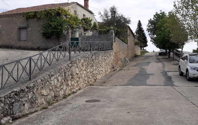
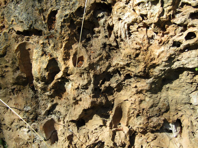
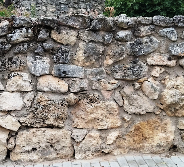
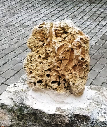
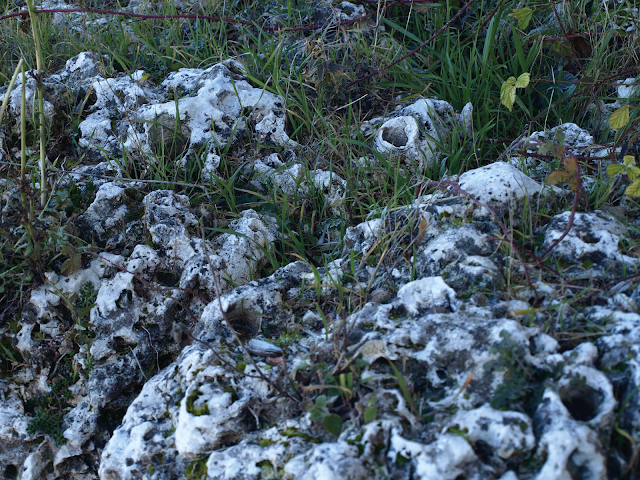
Punto 6. La Cueva Grande    (Plano Ruta 3) A lo largo del recorrido que va junto al arroyo, es posible ver un gran número de cuevas,  (o abrigos dada su escasa profundidad y amplia entrada), aprovechadas como tenadas para guardar el ganado. También es común por esta zona del pueblo la presencia de colmenas, (ya en abandono).  Estas cuevas, han sido originadas por el propio arroyo en momento de crecidas mayores a lo largo de varios cientos de miles de años, ya que el agua es capaz de disolver poco a poco el macizo carbonático, (que corresponde con la segunda barra carbonática).  La presencia de agua ligeramente ácida, (por la presencia de dióxido de carbono) en unión con el carbonato, genera una reacción química que disuelve la roca, y que puede volver a cristalizar en otros puntos.          𝐶𝑎𝐶𝑂3+𝐻2𝑂+𝐶𝑂2↔𝐶𝑎2++2𝐻𝐶𝑂3− Durante este camino, vamos a tener todo el tiempo a nuestra derecha, el Arroyo llamado “de la Fuente del Prado” o Arroyo de los huertos y que suministra agua a

ROUTE 1 WAYPOINT 9 AND ROUTE 2 WAYPOINT 9

Imagen
Waypoint 9: The Dolomites  Map route 1     (Map Route 2) We walk through the village and end the creation of "Hortezuelos"  that defines the depostional sequence DS-2. Even though we have finished our peculiar sequential and sedimentary analysis, the grat oscilations of the sea level during the superior Cretacic period continued to affect and generate sea rocks. To start, there are two updates to highlight, on the one hand we will no longer refer to rocks of Conician age, but of Santonian age (86,3-83,6 M.Y) and on the other hand we are no longer in the creation of "hortezuelos" but in the creation of dolomites of Montejo. This is of high relevance as we have to change our vision completely, if before we focused on the alternation between loam and chalky rocks, we now only have one dolomitic unit ( with dolomites in variable strata). Lets not forget that we are not speaking about chaly rocks, but about dolomites ( instead of  CaCO 3 , is  CaMg(CO 3 ) 2 ) this chang