Entradas

Mostrando entradas de julio, 2021

ROUTE 3 WAYPOINT 17

Imagen
Waypoint 17: Ochre Dolomites (Route 3 Map) At this point it is possible to find the ochre dolomites seen at point 8 again, although the quality of the outcrop is somewhat worse. We can see how it is made up of red dolomites formed by small oolites. All of them are associated with the moment when the sea level began to rise, but still with a low water level.

ROUTE 3 WAYPOINT 15

Imagen
Point 15: Pine forest (Route 3 map) Returning to the village, we pass through an area of reforested pine forest, a species which, although it can grow almost anywhere, is more characteristic of areas of loose siliceous sands, as can be seen in the pine forest soil characteristic of the province of Segovia. Pines are acidophilic species, i.e. they prefer acid soils formed by siliceous sands (as in this case) or similar.

ROUTE 3 WAYPOINT 16

Imagen
Waypoint 16: Puenton and Peroncillo (Route 3 Map) At this point, two nearby features stand out. On the one hand, the Puentón, the bridge associated with the old road, where you can see the stream coming from the large spring, it is possible to see the great wealth of riverside flora in this area. In this area there was also a settlement called Peroncillo, which had a small weaving mill, using the clay of the area to make bricks and tiles with the water from the stream. This bridge, with its perfect masonry, was taken from the Castrojimeno quarry.

ROUTE 3 WAYPOINT 14

Imagen
Waypoint 14: Fire tank  (Map route 3) At this point we find a small square-shaped water well designed so that the fire department helicopters can take water with the bambi (the big bag for refilling water).

ROUTE 3 WAYPOINT 13

Imagen
Waypoint 13: Fuente Grande (Route 3 Map) We reach the end of the path at what is called the Fuente Grande. This is the main spring in the village of Castrojimeno used as the main water supply. Next to the main fountain you can see the spring that supplies the stream. This is a detritic aquifer linked to the porosity of the ultrillas sands, and at this point where the piezometric level exceeds the surface and flows outwards, generating this spring.

ROUTE 3 WAYPOINT 12

Imagen
Waypoint 12: Arenero (Route 3 Map) Near this point, there is a sand quarry in Utrillas, one of the few places where the surrounding rock can be seen, although in this case the abandonment of the quarry has meant that the quality of the outcrop has been lost. Nevertheless, the sands can be seen in different colours, especially white, yellow and red, depending on the rock that gave rise to them.

ROUTE 3 WAYPOINT 10

Imagen
Waypoint 10. Siphon of the watering can (Map of Route 3) At this point, we can see a small irrigation channel or watering can called here, which used to carry the water needed to irrigate the vegetable gardens on the banks of the stream. It is a communicating vessel, to bridge the difference in level caused by the construction of the old road from Sepúlveda to Peñafiel, built at the same time as the so-called Puentón, which we will see later. It is formed by a closed stone conduit, with a square section, which is buried under the road and rises along the margins of the same and with the same section, and once the difference in level has been overcome, it continues with the watering place made in the natural terrain as a ditch. The outlets are covered with large stone slabs to prevent people or animals from falling into them.

ROUTE 3 WAYPOINT 11

Imagen
Waypoint 11: Riverside woodland and houses area (Route 3 map) We follow the path parallel to the river, and this generates the traditional riverside woodland along the banks with trees that need more humidity. The elms or poplars stand out in this area. We can also see, on the other side of the track, a hill called "El lomo de la casa", which suggests that this area was also a place of population settlement in ancient times, as it was close to water and orchards.

ROUTE 3 WAYPOINT 9

Imagen
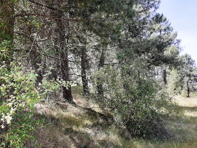
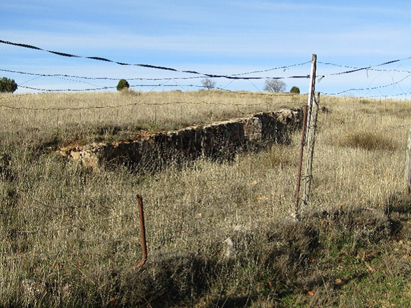
Waypoint 9: Arenas de Utrillas (Route 3 Map) From here onwards, the change is radical. To the west, there is limestone and dolomite, and carbonate soil in general (with the presence of flora typical of carbonate soils, such as juniper and juniper). From this point eastwards, the presence of sands stands out (although it is hardly visible). The Utrillas sand formation is one of the most recognisable geological units in Spanish geology. It is a unit of non-cemented sands (at least not at all points) of light colours (white, light red, pale green...) of fine grain size (usually no larger than a couple of centimetres in very specific points and above all it is sand size, less than 1 millimetre). At this point we can see a small ditch or irrigation channel called here, which used to carry the water needed to irrigate the vegetable gardens on the banks of the stream. These are communicating vessels, to bridge the difference in level caused by the construction of the old road from Sepúlveda t

ROUTE 3 WAYPOINT 8

Imagen
Waypoint 8: Ochre Dolomites (Route 3 Map) From this point we can see a small farm with roe deer, but the presence of a unit of ochre dolomites is particularly noteworthy from a geological point of view. The relevance of this unit is that it marks the beginning of the stratigraphic sequence that contains the main geological elements of interest in the municipality. This unit marks a period of low sea level with almost aerial exposure of the sediment, which generates oxidation and gives these ochre colours.

ROUTE 3 WAYPOINT 7

Imagen
Waypoint 7. Hornachos or small caves (Map of Route 3) Along the path that accompanies the stream, there is a proliferation of hornachos caves, or small caves that served as shelter from the inclemency of the weather for transient shepherds. The process is similar to what formed the previous caves, but it is possibly also associated here with the presence of underground water that gradually dissolves the limestone massif as well as the processes of landslides. A necropolis has also been found in this area, which has been dated to the middle of the 13rd century, possibly as a result of a battle of the period.

ROUTE 3 WAYPOINT 6

Imagen
Waypoint 6. La Cueva Grande (Route 3 Map) Along the route that runs alongside the stream, it is possible to see a large number of caves (or shelters, given their shallow depth and wide entrance), which were used to keep livestock. The presence of beehives (now abandoned) is also common in this area of the village. These caves have been created by the stream itself at times of major floods over several hundred thousand years, as the water is capable of gradually dissolving the carbonate massif (which corresponds to the second carbonate bar). The presence of slightly acidic water (due to the presence of carbon dioxide) together with the carbonate generates a chemical reaction that dissolves the rock, which can crystallise again at other points.          𝐶𝑎𝐶𝑂3+𝐻2𝑂+𝐶𝑂2↔𝐶𝑎2++2𝐻𝐶𝑂3− During this path, we are going to have all the time on our right, the stream called "de la Fuente del Prado" or Arroyo de los huertos and which supplies water to the orchards in this area.

ROUTE 3 WAYPOINT 5

Imagen
Waypoint 5. The washing channel and the drinking troughs   (Route Map 3) Going down to the Arroyo de la Fuente del Prado or Fuente Grande and after passing La Puentecilla and leaving Los Colmenares on the left, you reach the upper part of La Canal, a place where people washed their clothes and fetched water for the population when the water was not piped into the houses. A little further up there were two stone basins (currently used as planters next to the Association and in the Plaza del Empedrado) where the horses drank when they came from the fields to work. A rock with a very marked cross stratification is striking. Cross stratification is an internal structure due to the sedimentary origin of the rocks and is related to the movement of currents (usually water) and generates structures called Ripples or submarine dunes that are moving thanks to the currents.

RUTA 1 PUNTO 8 BIS Y RUTA 2 PUNTO 5

Imagen
 Punto 8 bis. Bloques decorativos con rudistas.  (Plano Ruta 1)    (Plano Ruta 2) En el comienzo de la carretera de atrás y la calle Mirador de la Peña, se encuentran estos bloques decorativos con abundantes rudistas. Tradicionalmente se han aprovechado las piedras del entorno para construir y aquí tenemos un claro ejemplo de ello. 1) Vista de Hippurites incisus en sección perpendicular: Es muy fácil apreciar la característica concha con dos pilares internos muy marcados y una pequeña cresta ligamentaria. 2) Bloque con abundantes Hippurites incisus 3) Bloque donde es fácil apreciar la concha de Biradiolites angulosus, con sus laminas características, marcadamente plegadas.